Landscape Salar de Uyuni Present Year
The Salar de Uyuni is found in an arid region. We know this
because that’s how the salt flat was formed. It used to be a giant prehistoric
lake called Lake Minchin (ThoughtCo.).

However, due to the arid climate and having
an uneven moisture deficit, the lake evaporated over thousands of years. This
is also due to the Salar being a drainage basin that provides a permanent
inflow from the Rio Grande de Lipez to the southeast (Orris). The water of the
lake was filled with minerals and salt. Meaning when the water evaporated, the
salt was left behind. The Salar de Uyuni is a solonetz, or a salt playa due to
this (Lecture 23: Arid Landscapes).
Landscape Salar de Uyuni 10,000 Years from Now
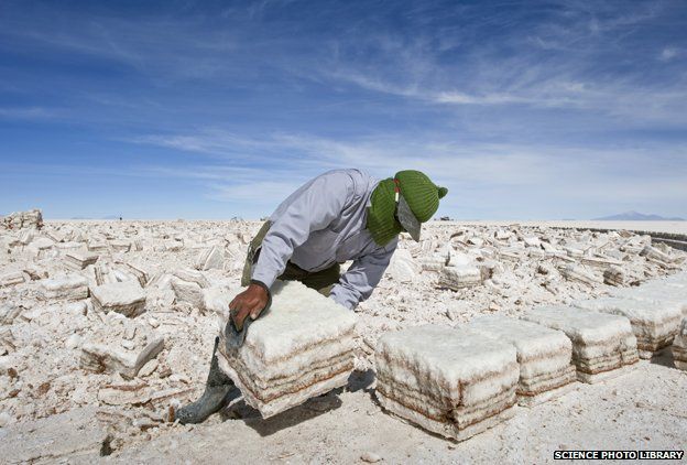 |
| Mining for lithium under the surface of the Salar de Uyuni (BBC). |
With
this depletion of minerals and brine from the soil this would make the rainy
summer months create a wet muddy surface. This is because with humans taking
more salt than can be replenished by the rainy season, the surface loses mass
and is now more permeable. Water is now able to percolate, eluviate, and
translocate materials (Lecture 23: Arid Lanscapes).
| This diagram shows an example of percolation (imgarcade.com). |
Proof of this happening
before can be found in Utah. Utah’s Bonneville Salt Flat has been struck with
this occurrence the past two years. With mining depleting the salt from the
soil faster than it can form, when the rain comes the salt pan turns to “gray,
gritty soup” (Scientific American).
Landscape Salar de Uyuni 1,000,000 Years from Now
 |
| Tunupa Volcano (Morgan J Salisbury). |
Landscape Salar de Uyuni 10,000,000 Years from Now
The Andes mountains are surrounding the Salar de Uyuni. They
are created by the Nazca and South American Plate (Salisbury, Wired). Over
millions of years the plates will have been forced together and pushed apart
from continental drift and plate tectonics. The massive mountains of the Andes
will have become smaller. This is due
the Earth trying to reach isostatic balance. The plates try to adjust
themselves so that they are both 5/6th’s submerged (Lesson 11: Plate
Tectonics). With the mountains no longer an obstacle, water is able to reach
the Salar de Uyuni regularly. The evaporated water from the ocean is pushed by
the Southeast Trade winds and over the Salar de Uyuni. With this increase in
moisture and water the moisture deficit is not imbalanced anymore. The lake
begins to form again and with each rainy season becomes bigger and bigger.
References
Thought Co., https://www.thoughtco.com/salt-flats-geography-1435836.
Morgan J. Salisbury, Wired. https://www.wired.com/2011/07/guest-post-unusual-volcanism-in-the-central-andes/.
Scientific American, https://www.scientificamerican.com/article/the-race-to-save-the-bonneville-salt-flats-from-a-slushy-demise-slide-show1/.
Orris, G.J. BIBLIOGRAPHY
AND SUMMARY OF DATA AVAILABLE FOR THE SALAR DE UYUNI, BOLIVIA. U.S. DEPARTMENT OF THE INTERIOR U.S. GEOLOGICAL
SURVEY.
|
No comments:
Post a Comment